North Island
New Zealand facts & history in brief
 New Zealand Map
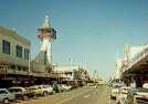
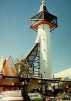
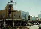
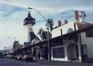
Masterton
is a thriving servicing centre
for a rich farming area of the Wairarapa
with about 25 000 people, just over
100 km northeast of Wellington.
Masterton was surveyed and settled by
Wairarapa Small Farms Association,
led by Joseph Masters, in 1854
and named after him.
The Rimutaka Range obstructed easy
access into the Wairarapa and
prevented the development of the region.
A road over the Rimutakas was opened
at the end of the 1850s,
and a railway in 1880.
A railway tunnel, completed in 1955
made the arduous journey much easier.

You can click on these photos for an enlargement.
 |
 |
 |
 |
|
Masterton |
Masterton |
Masterton |
Masterton |
Site
Index
Back to Top
Photos Index
Thanks for coming, I hope you
have enjoyed it, will recommend
it to your friends, and will come
back later to see my site developing
and expanding.
I'm trying to make my pages
enjoyable and trouble free for everyone,
please let me know of any mistakes
or trouble with links, so I can
fix any problem as soon as possible.
These pages are best viewed with
monitor resolution set at
800x600 and kept simple on purpose
so everyone can enjoy them
across all media and platforms.
Thank you.
Webmaster

|